As the week approaches, a critical weather alert is taking shape for Indiana, particularly on Wednesday, with significant risks of flooding and severe storms. The National Weather Service has issued warnings that multiple storm systems could impact the region, bringing intense rainfall and potentially dangerous wind conditions. These events are not isolated but part of a broader pattern of atmospheric instability that has been building across the Midwest.
Are Flooding Threats Realistic This Wednesday?
Yes, the potential for flooding is significant. The latest updates from the National Weather Service indicate that Wednesday could bring multiple rounds of thunderstorms, with some areas experiencing up to 3 inches of rain within a single hour. This level of precipitation is particularly concerning because it falls well above the threshold for flash flood warnings, which typically require at least 1 inch of rain in an hour. The combination of saturated ground from previous rainfall and the continued influx of moisture is creating a perfect storm for rapid runoff and localized flooding.
The impact of these storms is not just limited to rain. As noted by the Weather Impact Alert system, strong gusts of wind could also pose threats to infrastructure and safety. In areas where the ground is already saturated, even moderate rainfall can quickly overwhelm drainage systems, leading to dangerous situations for residents.
What Exactly Should Residents Do?
- Monitor local weather updates through the National Weather Service app, which provides real-time alerts for your specific location.
- Ensure that emergency kits are ready, including items such as flashlights, batteries, and important documents.
- Check your home for potential vulnerabilities like basement flooding risks or drainage issues.
It's crucial to act early, as delays can lead to more severe consequences. The National Weather Service emphasizes that the timing of these storms—between 6 PM and midnight—is especially critical, when the highest risk of flooding is likely to peak.
Historically, similar weather patterns have led to significant disruptions in the region, with past events highlighting the importance of preparedness. For example, in 2022, a series of intense storms caused widespread flooding in parts of Indiana, affecting over 10,000 households. This underscores the need for proactive planning and awareness.
While the storm system is expected to move through in stages, there is a chance for additional rounds of storms to develop later in the week, increasing the likelihood of prolonged and intense rainfall. The National Weather Service has issued a Weather Impact Alert for Wednesday, which signals that this is not a routine event but one that requires immediate attention.
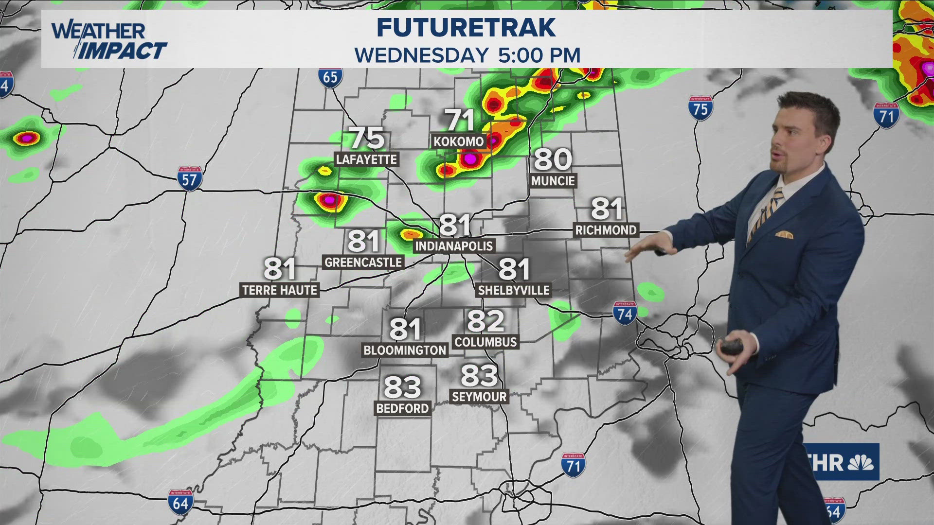
Residents should also be aware that the weather system is moving in a specific pattern, with the most severe conditions expected in the evening. The National Weather Service has identified key areas where the risk is highest, particularly in the eastern parts of the state.
Ultimately, the focus should be on preparedness and awareness. By staying informed and taking proactive steps, residents can mitigate the impacts of these storms and ensure safety during this critical period.